Pinhoti Section 2

The Ole Bike sits ready, waiting to launch us on section 2.
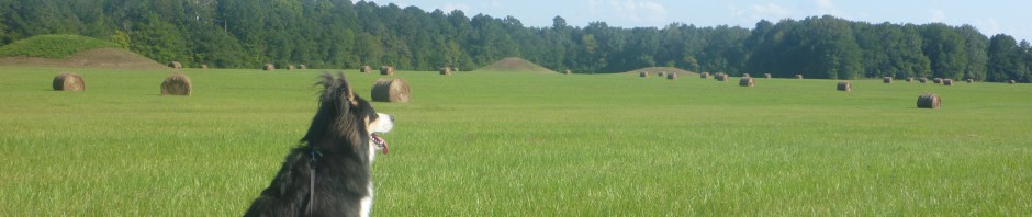
Traveled with: no one!
Method:Biked- I highly recommend you ride this section. Walking it seems pointless and would take too long. Unless you’re going from Fl to Canada as several people already have, using the Pinhoti as a connector to the Benton MacKaye Trail (BMT) then onto the Appalachian Trail (AT)

Couldn’t they make those helmets a little more attractive? Mushrooms. Mushrooms.
Road Etiquette: Most cars passed me nicely but a CHURCH van and the tiny car tail gating it did NOT give me the three feet that is suggested as the appropriate and safe limit to give cyclists. They did not move.over.at.all. The car flew by me so fast and so close if I had put an elbow out I’m sure they would have hit me. I noticed with a strange sense of almost detached anger as their tires never passed over the middle line to give me room or even moved at all and these are narrow back roads we are talking about. They also had a long stretch of space ahead to see no one was coming. If you are a cyclist this is bound to happen, but I expected it on a city street where maybe there wasn’t room and you have to get by with hugging the middle line, but still, you are dealing with peoples lives and if you don’t know how to pass a cyclist please google “how to pass a cyclist” for a variety of types of blog entries but here’s one that should suffice: http://knoxify.com/knoxville-drivers-how-to-pass-a-cyclist/ This is the main reason I don’t bike with my dog on streets *anywhere* because I like my dog alive. I know someone would hit us.

Ty nice drivers for passing properly and giving space 🙂
Length: 9.8 miles according to the Pinhoti Trail Alliance though an app we loaded on my phone that I carried with me showed it to be slightly shorter despite two stops on side roads. No data gathered in this way is perfect!
Time taken to travel: Approximately 1 hour 10 minutes- I’m not sure, but I’m betting I’m a lot slower than most people! Plus I couldn’t get it to go into lower gear 😦 and spent some time trying to fix that.
Breaks: 2. One to curse and kick at my bike that wouldn’t shift gears even though I paid A LOT for Cahaba Cycles in Homewood to “Fix” this problem. So I did most of my travels in middle of 2nd gear… One break to show bike to Husband at halfway point and curse and kick at it. Don’t let the cursing fool you. I was having a great time, just bemoaning the money I spent to fix something that didn’t fix it. (On a side note the nice guys at the cycle shop assure me it is fixed now 🙂 I guess I’ll put it to the test soon enough since the weather is cooling off!)
Dogs: Approximately 10 or 12. Only two gave full chase but luckily they had been chasing a car for a MILE so when I caught up to them they could do little more than wag their happy tails and run alongside me. Yay for tired pups. The rest of the dogs only barked at me to alarm owners of my passing.. but they needn’t do that since my bike made LOUD uncontrollable clanking because it wouldn’t go into gear.
Funnily enough I passed almost as many roosters as dogs. They and their chicken counterparts also did their best to warn their beloved owners of my approach (Clank Clank Clank GRIND) and they were mostly free range. I wish we could let ours free range… but they’d be over the fence before I knew it. We need more land 😀 !
According to a program my husband loaded called “My Tracks” on Android here is the following info gathered from my trip:
Total distance 9.5 miles. Average moving speed 33.3 mph, max speed reached 80.5 mph (I have a HARD time believing this one though I did get a lot of speed going down a few hills. I’m just including it to show that some of the data gathered from this program has to be wrong LOL! 80? Yeah…right!)
Max elevation: 264 m (867 ft)
Min elevation: 196 m (644 ft)
Elevation gain: 123 m (403 ft) I’m pretty sure that this is the danged hill my gears said “You want a low gear? hah! I laugh at you!”
Max grade: 7 %
Min grade: -15 %
I road North to South. Traditionally people travel South to North on the Pinhoti. The first section we did we headed North. But with my back as bad as it was, after seeing the terrain, I decided to head South as it would leave me going down hill more of the time (but don’t worry, there’s still a few hills for you!).
I would like to personally thank Brandon for coming out and dropping me off, meeting me halfway to look at my gears and taking my tired sweaty butt back home. I’m very thankful and blessed to have a husband who supports all of my crazy dreams, from long distance hiking to raising our own chickens. You make life more fun, you make me feel important, and you support my dreams. I cannot thank you enough.
Problems: we started late because I forgot my phone. Already terrified of riding my bike alone (No Brandon, you can not ride along behind me at slow speed the whole way) I realized without my phone I would be paralyzed. So we returned got it and headed out. Of course, we were already leaving late (we are always leaving late it’s hereditary in my family).
Also another problem you will find is with the directions. The PTA (Pinhoti Trail Alliance) has some outdated info on their site. Some of it is over a decade old. If you look at their site you’ll understand how this happens. There’s a gazillion links organized in a very 1990’s way. I’m surprised there isn’t any blinking gifs of cartoon hikers or bold stripes blinking along the top and bottom. A massive amount of listed links like that would be hard to stay on top of in regards to keeping up to date. But here’s one major problem we ran into- road names. The best thing you can do is a) know that the restuarant they tell you to park by hasn’t existed in *years* so park by the Dollar General instead and b) get on google maps and when you get to tricky intersections use the little man to put you on the virtual driving view… I’m not sure if that’s called the “street view” or what. But if you’ve ever used Google Maps then you know what I’m talking about without names 🙂
What I did to prepare was to look at the maps, then when we got there we drove the route in the car so I’d know where to go once I was alone on the bike. I had fine cell reception on the way. Some of the roads were named different so I’m glad we took the time to closely look at google maps and drive it. For instance we didn’t see any sign for “CR 511” but apparently that is Goodwater Hwy. Also, FS 603A didn’t show up on google but we found it fine 🙂 Also, the “Trailhead” isn’t marked with a sign, but there is the gate they talk about and we saw a blue blaze so we knew we were in the right place. The gravel you’re going to ride out on for the first mile or so can be tricky I bet with certain types of bikes. We put parentheses around “road” in the PTA directions when they said “When you come to the fork in the “road” with a gate at the left fork, you are at the trailhead parking area.” Don’t block the gate btw if you’re leaving a car. Again only room for about one or two cars. And when I started my backpacking trip they were continuing improving the “road” as it winds through the woods there; really doing some hardcore work on it. So it might not need parentheses for very much longer.
If you want links to Pinhoti stuff see my last entry that has some links at the bottom and don’t hesitate to message me on FB on Whiskey’s page if you have any questions about biking or walking this section. I’ll be glad to help in any way I can! Hope to have Pinhoti backpacking stuff up in a few days.
Y’all take care and despite leaving Whiskey at home during all my Pinhoti adventures, know that I hope you get out there with your dog at some dog friendly places, and always know when it is too hot, too dangerous, or just too darned much to bring your dog along (such as with much of the Pinhoti). Don’t feel bad for leaving him at home if it’s not the best environment for him. Sometimes the outdoors is safer with just us looking after ourselves!
Happy hiking (or er…cycling!),
g

Pingback: A (somewhat) wordless Wednesday- Pictures of Section 3 Pinhoti | Whiskey on the Rocks